Bathymetric Mapping

eTrac is built upon the understanding that bathymetric mapping is a specialized industry: our professional staff holds advanced degrees, professional land survey licenses, CG Captains Licenses, CDL & DOT certifications, extensive training, and certifications by the ACSM/THSOA. Our staff brings decades of professional experience acquiring multibeam, singlebeam, sidescan, and sub-bottom sonar data in the most challenging coastal environments. The hydrographic surveys performed by eTrac adhere to IHO, USACE, and NOS Hydrographic Survey Standards and are supervised by a Certified Hydrographer and Professional Land Surveyors.

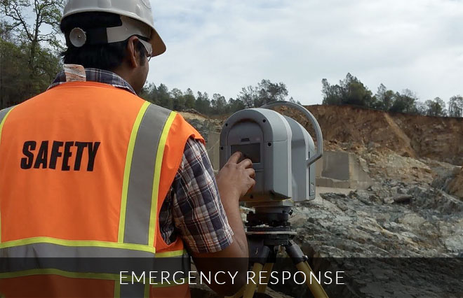
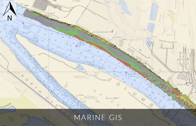
eTrac has completed large and small scale hydrographic survey projects for governmental and private sector clients across the country and internationally. Our most common survey areas include California, Alaska, Hawaii and the Great Lakes region. All of our gear is completely mobile with the ability to travel and mobilize any vessel worldwide. Our products, analysis, thoroughness, expertise and prompt delivery have creatde regular repeat clients and multiple sequential awarded contracts through NOAA and USACE.

Dredging Quality Management

In addition to providing hydrographic survey support for dredge projects, eTrac offers custom United States Army Corps of Engineer Dredge Quality Management / Silent Inspector compliant systems for dump scows, hopper dredges, and other marine construction equipment. eTrac provides the technology, equipment, documentation, reports, and data forwarding necessary for contractors to meet their USACE contract obligations.

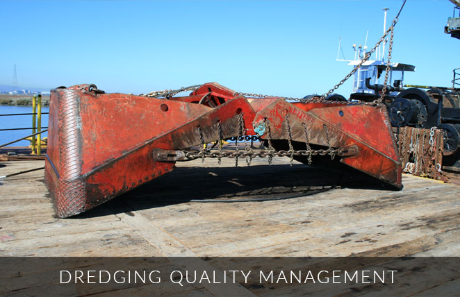
USACE Profiles Supported:
•  Tracking Profile
•  Monitoring Profile
•  Ullage Profile
•  DS (Tons Dry Solid) profile

Environmental Protection Agency (EPA) Vessel Monitoring

•  Full Sensor spread to meet 3rd Party Requirements
•  Email Alert system
•  Secure FTP Data Upload

eTrac has the tools and knowledge to comply with all your Real-Time vessel monitoring needs throughout the continental US, Alaska, Hawaii as well as international locations.

Electronic & Automated Positioning

eTrac provides positioning services for a number of marine applications including commercial diving applications, bridge pier maintenance, and pipeline stabilization. With the use of technologies such as MS-1000 side scanning sonars and Blueview 3D scanning sonars, eTrac is able to provide realtime positioning in challenging marine environments in support of most any marine construction project. With USBL tracking beacons, we are capable of tracking and positioning towed systems and sonars during survey operations. USBL beacons have also been used to track diver positions while working on marine construction projects.

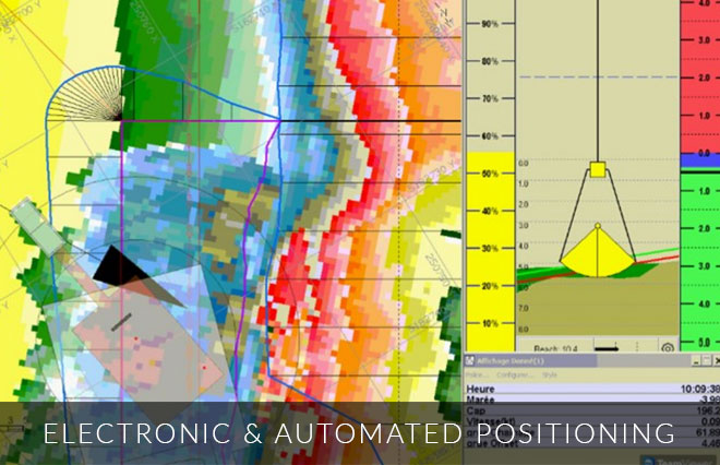
eTrac’s technology has been applied to a full range of machine control installations, from hydraulic cutter-suction dredges to hopper dredges with multiple sensors inputs and PC and PLC integration. Our group combines creativity and field-tested experience with fully-integrated circuit design, programming and construction capabilities providing tailored solutions to our clients. eTrac also provides wireless telemetry options to allow for remote viewing, training and bi-directional data access for increased safety and productivity.

Emergency Response

eTrac’s prompt response rate and quick data delivery turnarounds to time-sensitive situations has provided critical information in the decision making for emergencies. eTrac has provided forefront support to natural disasters such as earthquakes near ports and shipping channels as well as logistical catastrophes such as dam failures, sinking barges, potential oil leaks and anchor drags over marine utilities. Due to our large fleet and ample equipment inventory, eTrac has arrived on-site within hours of being notified. With our experience, eTrac surveyors are able to perform any last-minute request the client or circumstance requires. Our gear is mobile and ready to ship worldwide to be used on any vessel.

Environmental Remediation

eTrac’s knowledge and array of top-of-the-line equipment allows for in-depth analysis and tracking of resources. eTrac has been tasked with sediment change analysis over days or years, identifying and tracking features in marine protected areas, determining sediment differentiation in ocean disposal sites, analyzing the integrity of a waste outfall pipe, and locating objects that need to be removed in order to proceed with other marine logistics. Using our suite of software, eTrac can provide difference surfaces, cross-sections, volume calculations, object detection and tracking, spans or inflections over a pipe, and sediment classification. A range of deliverables can be provided per the client’s request.

Geodetic Survey

eTrac has the ability to set benchmarks and establish horizontal and vertical control while adhering to NOAA and USACE standards. Static GPS sessions and differential leveling runs are used to establish local control with most projects. Topographic survey services are available to support coastal mapping projects, including shoreline monitoring, dune restoration and buried beach utilities such as manholes and transformers. Topo surveys are used independently or combined with multibeam datasets for a virtually seamless overlap of the two. By combining multibeam sonars with topographic data, eTrac is able to create merged point clouds throughout the coastal environment, regardless of waterline location.

Geophysical Survey

eTrac’s knowledge and array of top-of-the-line equipment allows for in-depth identification, tracking and analysis of buried pipelines, cables or resources. eTrac has been tasked with digitizing buried pipeline or cable alignments, locating anchors, and even unexploded ordinances left behind from WWII. Within a single geophysical survey the buried pipeline or cable alignment, inflections, crossings, objects near the alignment and sediment classification can be defined. If a survey is repeated quarterly or annual, updated burial depths and analysis on significant sediment movement can be completed. Based on the client’s preference, deliverables include a custom feature database to identify tracked features in formats such as ARCGIS databases, custom CSVs, CAD plots and in-depth reports.

Marine GIS

Custom marine GIS websites are created to provide an accessible platform of our provided services specific to the client. All included surveys and features can be toggled on and off in a layer menu option. During survey operations, these websites are updated daily with bathymetric and sidescan coverage so the client can track our progress throughout the survey area. Upon completion of the data collection, client specified features such as marine utility alignment, spans, inflections, objects, wrecks, geological features, difference surfaces, and more are incorporated into the site. Features’ locations are marked with a point or a polygon based on the feature’s shape. Each feature can be clicked on and a pop-up window will appear with additional details and point cloud imagery. ROV locations with working video links as well as current and archived vessel traffic near the survey area can also be included. If the survey is reoccurring, difference surfaces and areas with significant sediment movement can be provided in the layer menu option.

Marine Vegetation Mapping

eTrac’s collection of equipment and software allows for various collection modes, such a ultra-high-density and high-resolution, to emit over marine vegetation in order to track its location in high-detail. eTrac has surveyed marine seagrass, eel-grass, and corals with the focus to protect and prevent further loss of these marine environments. eTrac has worked with highly protected eel-grass including the movement and re-nourishment of eel-grass correlated to dredging operations.

Object Detection

With use of cutting edge technology, eTrac is able to detect objects with high-accuracy. eTrac has been tasked with a variety of object detection surveys including annually analyzing a shipwreck near a natural gas platform, detecting objects and routes near marine utilities, comparing shipwrecks to nautical charts to produce Danger to Navigation reports, detecting lost anchors in recovery efforts and locating the position of submerged barges in emergency situations. Whether a client is specifically looking for something or just looking to see what could hinder shipping and dredge operations in an area, eTrac creates feature databases to identify, image and track objects in formats such as ARCGIS databases, custom CSVs, CAD plots and in-depth reports.