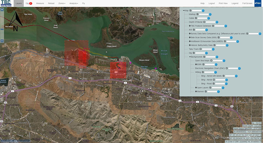
 A custom geodatabase can be designed and created in an ARCGIS and web-based format to house various information collected during data acquisition, post-processing and/or the in-depth analysis. The layering of the various georeferenced datasets is possible using comprehensive GIS software tailored to the client’s needs. Examples of tracked features include cable or pipeline alignments (exposures, spans, crossings, inflections), support structure (mattresses, sandbags), multibeam data colored by depth or dredging specifications, difference surfaces between surveys, backscatter data, burial depths from subbottom surveys, objects sandwaves, ridges, zones of significant sediment erosion or deposition, and rocky outcrops. The multibeam and/or backscatter coverage can be updated daily to show clients progress. All of the tracked features in the geodatabase can be turned on or off in the layer menu option; each feature can be correlated with pop-up windows to show additional details including the year it was first identified, any changes from previous years, measurements, imagery from the 3D point cloud, etc. Surveys from different periods of time over the same area can be viewed with transparency (0-100%); this option is helpful to visualize the difference between surveys – such as the updated location of an eroding ridge or the locations of newly installed support structures. The background layers are various charts and maps (NOAA, Bing, Google). AIS tracking system can be included to show live-feed of vessels in the area with pop-up windows with details of the vessels; it can also record a vessel’s location when it comes near your marine utilities or area of interest. The geodatabases are customizable to the client’s needs in order to assist the client in tracking historic data, monitor current data, foresee future trends and be proactive for incidents that may arise.