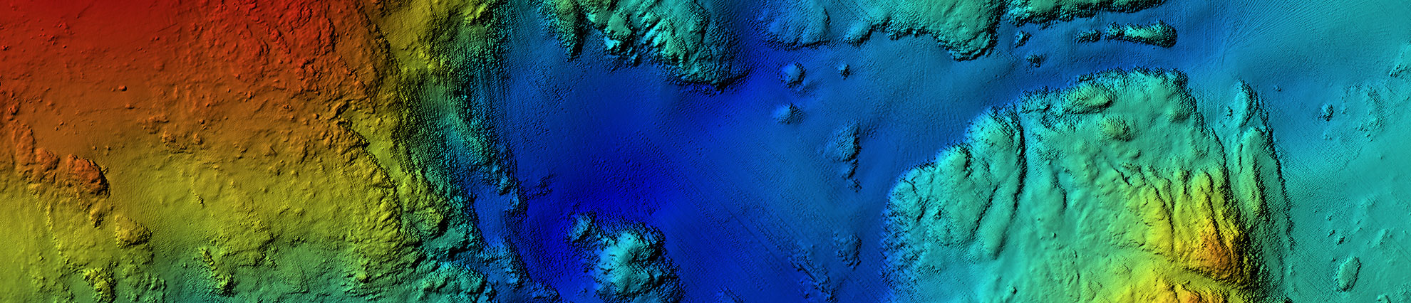
 Bathymetric Mapping
eTrac is built upon the understanding that bathymetric mapping is a specialized industry: our professional staff holds advanced degrees, professional land survey licenses, CG Captains Licenses, CDL & DOT certifications, extensive training, and certifications by the ACSM/THSOA. Our staff brings decades of professional experience acquiring multibeam, singlebeam, sidescan, and sub-bottom sonar data in the most challenging coastal environments. The hydrographic surveys performed by eTrac adhere to IHO, USACE, and NOS Hydrographic Survey Standards and are supervised by a Certified Hydrographer and Professional Land Surveyors.
eTrac has completed large and small scale hydrographic survey projects for governmental and private sector clients across the US and internationally. Our most common survey areas include California, Alaska, Hawaii and the Great Lakes region. All of our gear is completely mobile with the ability to travel and mobilize any vessel worldwide. Our products, analysis, thoroughness, expertise and prompt delivery have created regular repeat clients and multiple sequential awarded contracts through NOAA and USACE.