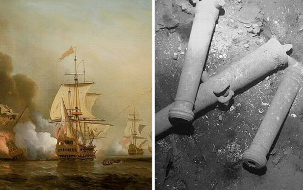
From mapping shipping channels to finding sunken treasure ships – the applications of hydrographic survey are limitless! To read more about Columbia’s recent discovery, click here.

From mapping shipping channels to finding sunken treasure ships – the applications of hydrographic survey are limitless! To read more about Columbia’s recent discovery, click here.
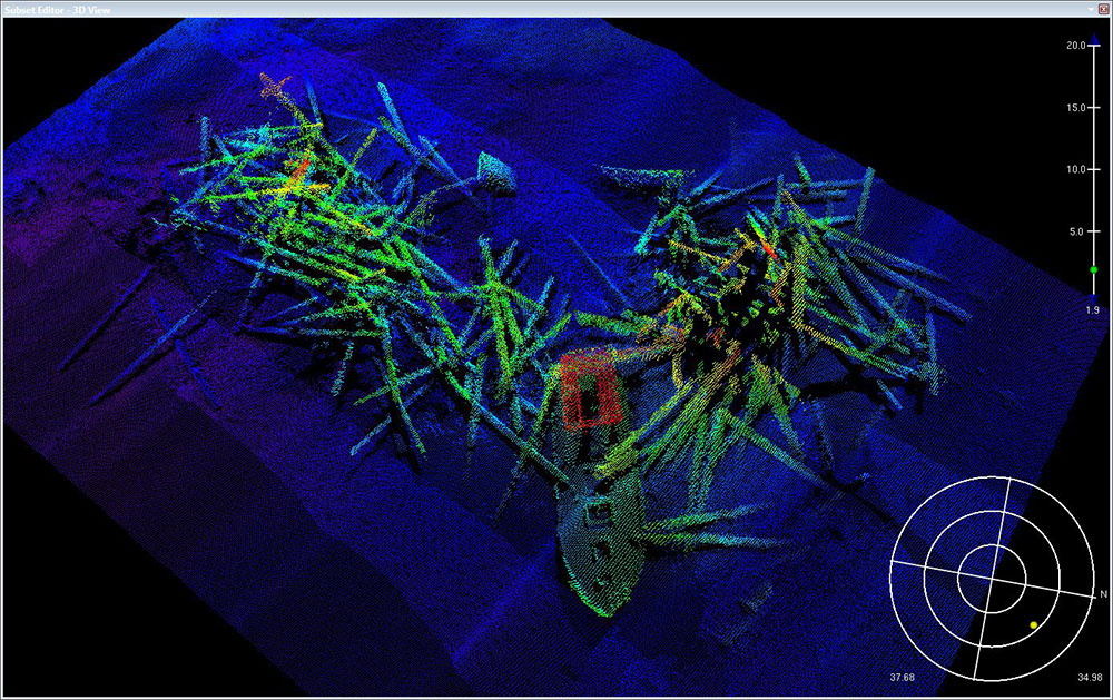
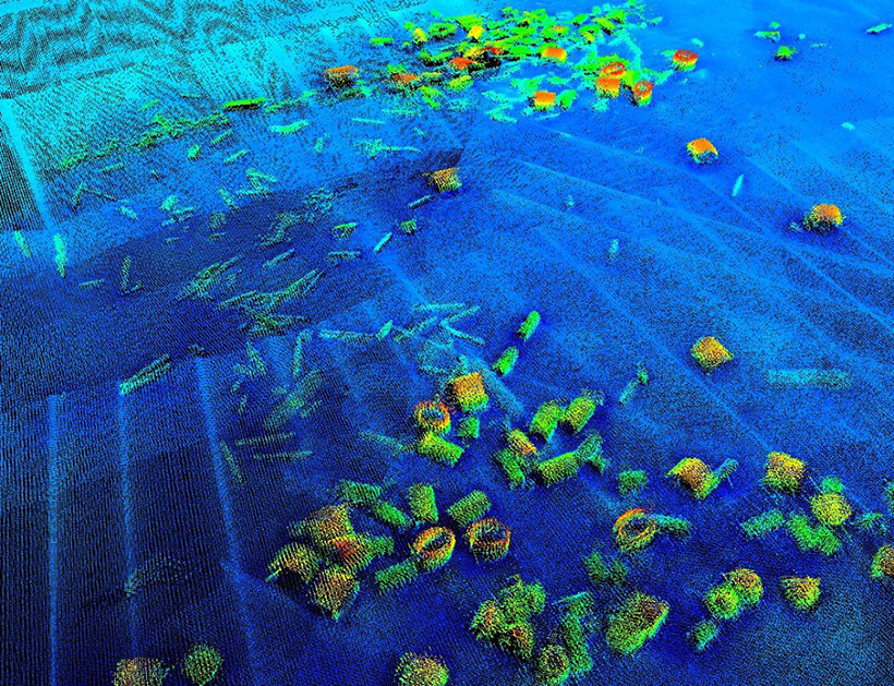
Sonar imagery of the seabed and structure of the Bay Bridge pier before the implosion and post-implosion. Apparent success for the first of a dozen or more to come during the coming years. It’s exciting to be a part of such a unique effort that is core to our local infrastructure in SFBay!


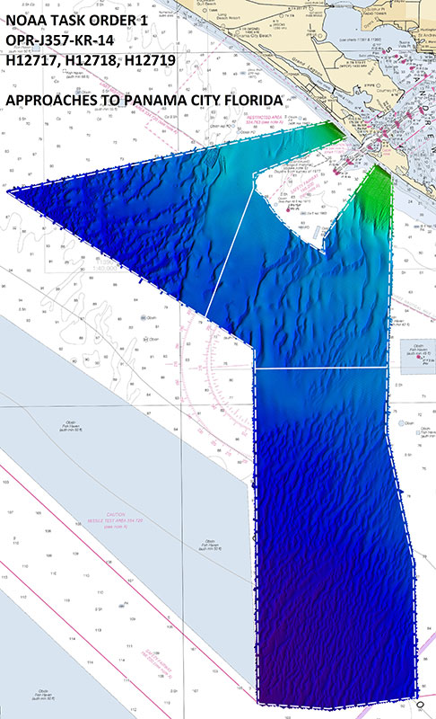
In early 2015, eTrac Inc. was awarded a contract to map approximately 80 Sq. nautical miles within the Gulf of Mexico. The survey effort focused on mapping the approaches to Panama City, FL in order to update nautical charting products to a modern standard.


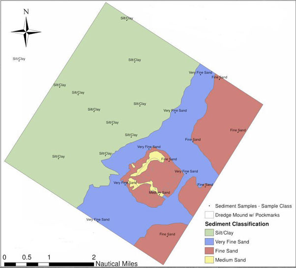
eTrac completed a multibeam survey of the Humboldt Ocean Disposal site approximately 10 miles offshore. Mulitbeam and snippets data were collected on an R2 2024 down to 400ft to create both bathymetry and backscatter grids. A sediment classification map was created using this data with sediment samples collected across the area.


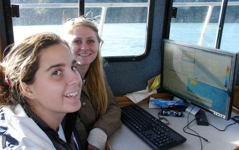
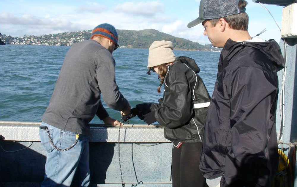
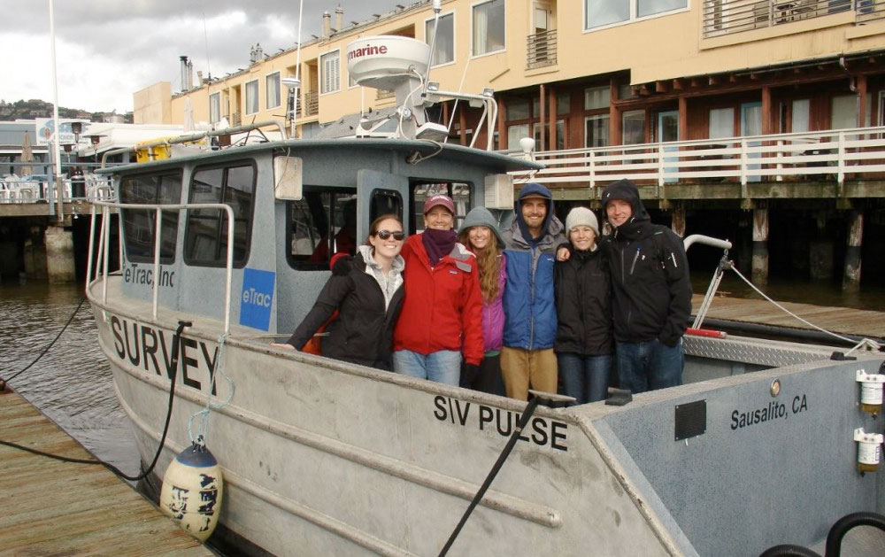
eTrac hosted 8 students from the College of Charleston’s BEAMS (BEnthic Acoustic Mapping and Survey) Program to conduct a survey of Raccoon Strait in the San Francisco Bay. The students were able to learn and assist in the survey set up and acquisition, gaining valuable hands-on experience. Students in the BEAMS program will be able to process and analyze the collected data during future research and independent study projects.


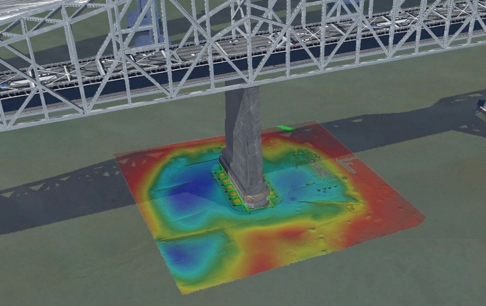
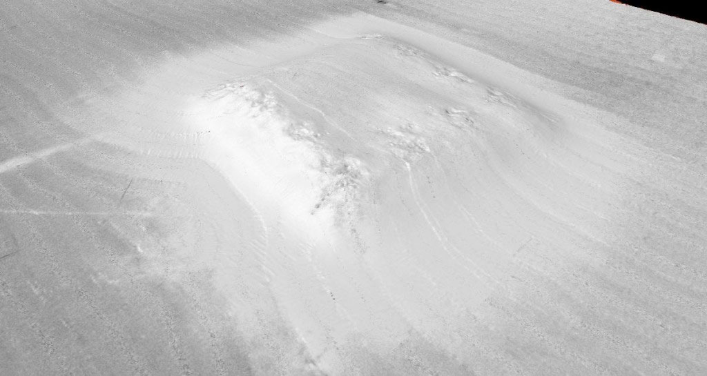
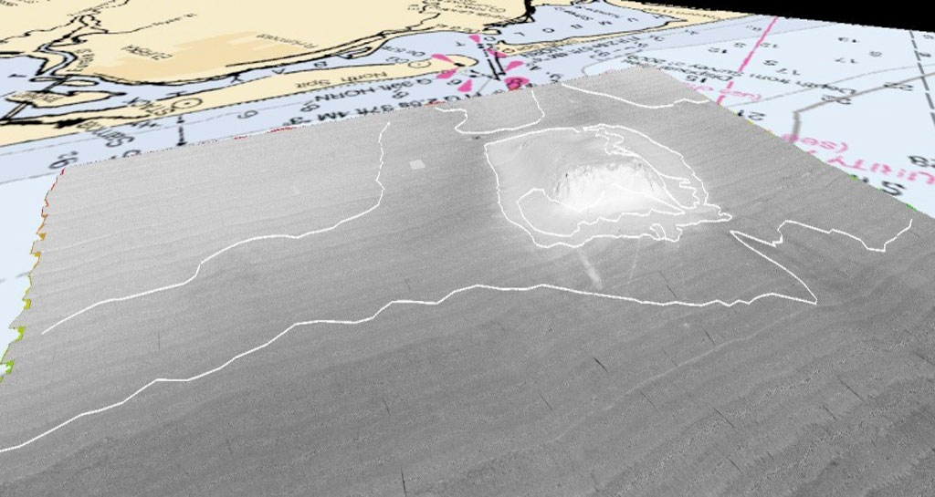
Multibeam hydrographic surveys have been conducted around a pier of the San Francisco Bay Bridge in preparation for further bridge deconstruction. Multibeam data was acquired using an R2Sonic 2024 coupled with an Applanix POSMV Wavemaster V5 Position and Motion System. Multibeam imagery was used to view possible obstructions in the area. 3D image of the bathymetric terrain and base of a pier of the San Francisco Bay Bridge was processed and visualized using QPS Qloud. 3D anaglyph images were created using custom R2Sonic 3D visualization software.