Ocean Cleanup

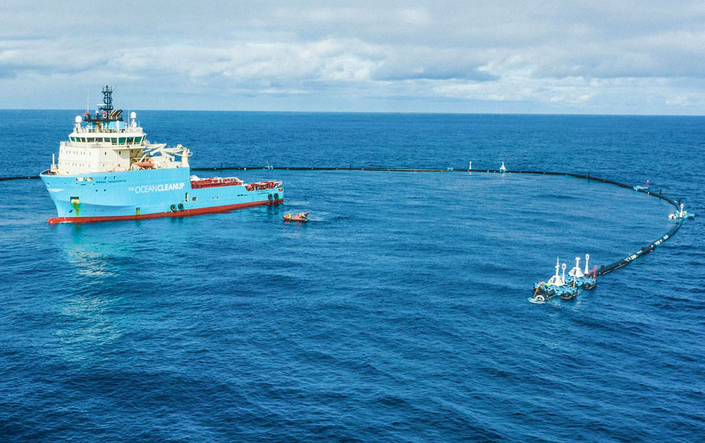
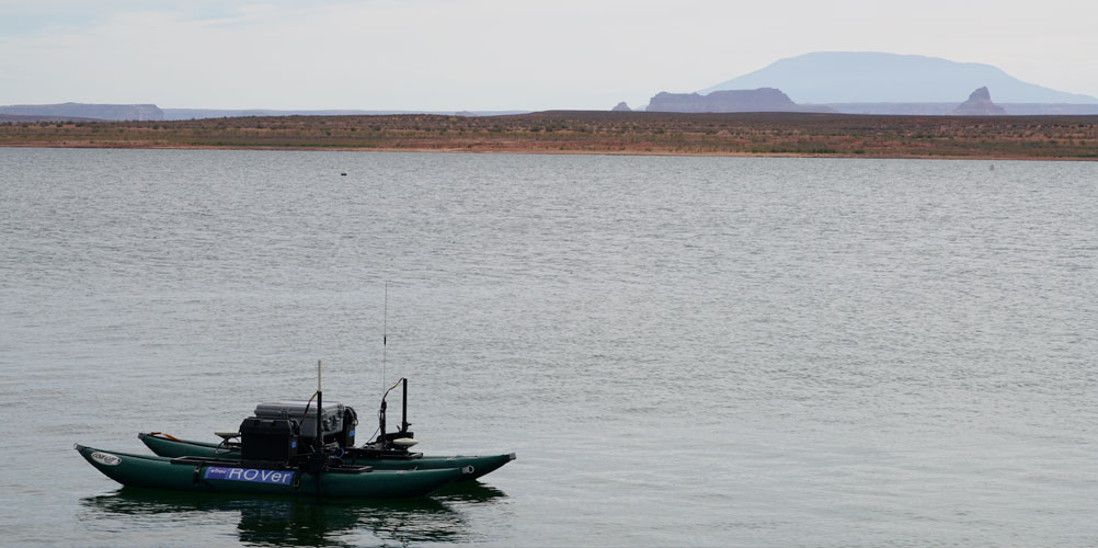
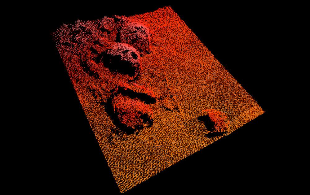
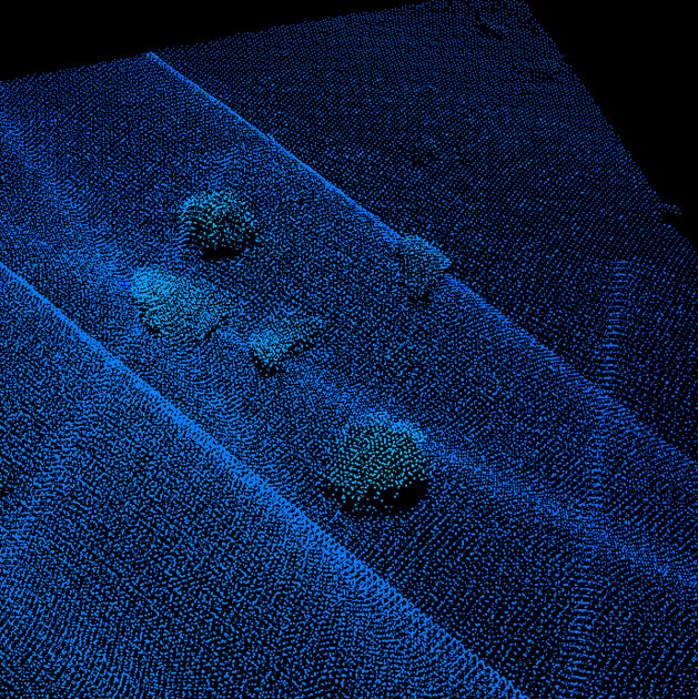
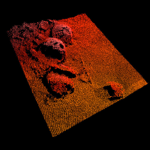
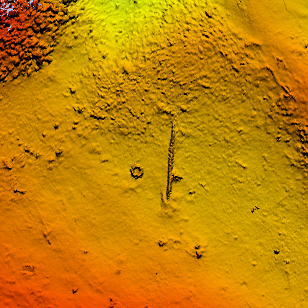
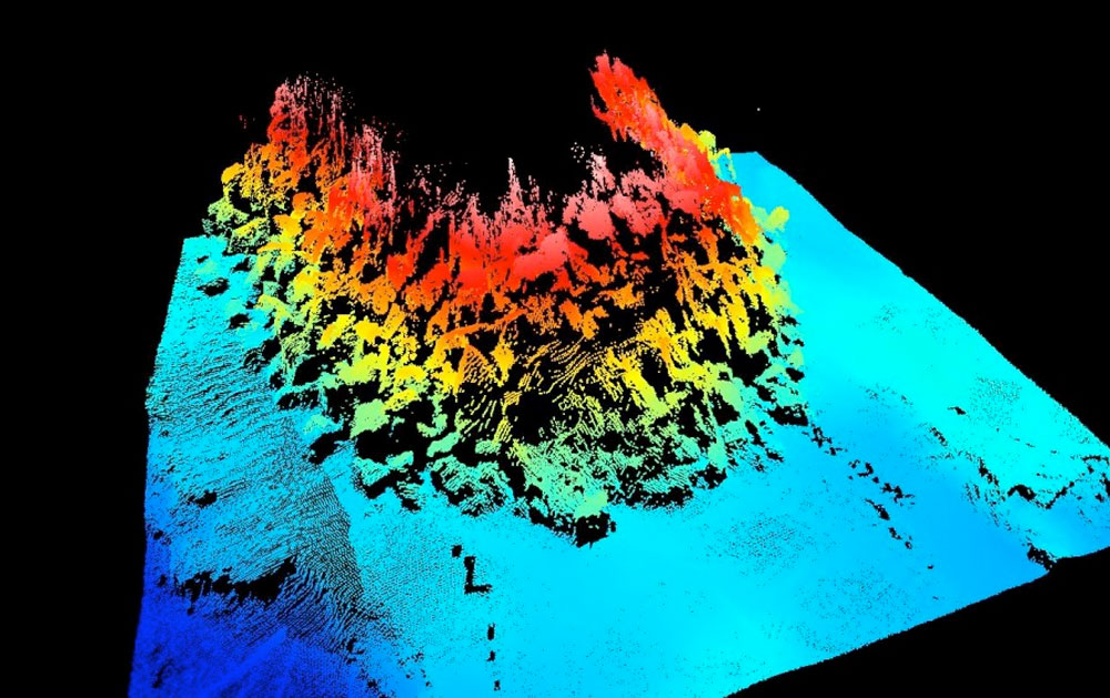
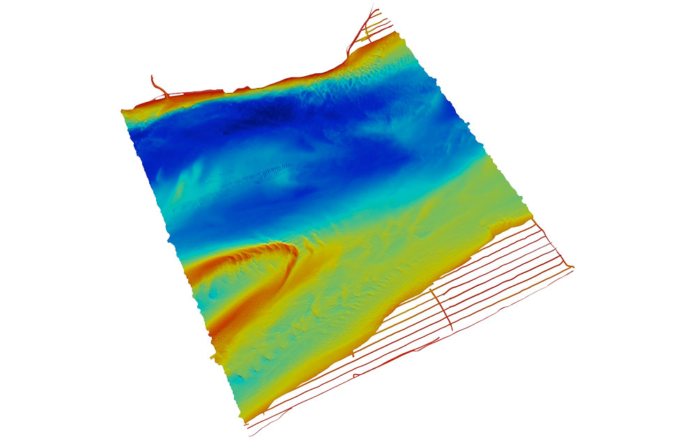
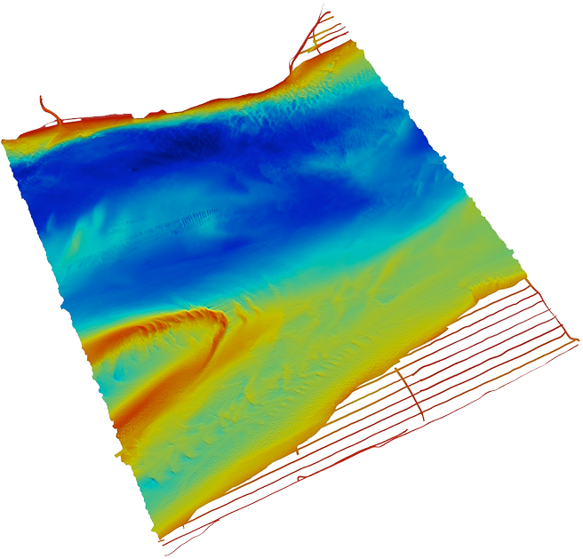
The Ocean Cleanup has issued an extensive update on their website announcing the assembly of their first cleanup system and upcoming tow test that will take place 40 nautical miles outside of San Francisco. Just five weeks ago, The Ocean Cleanup was signing the lease on their facility and is now getting ready for their first Pacific testing phase. This is the worlds first ocean clean up system and eTrac could not be more excited to have contributed to this effort. eTrac conducted the multibeam survey at their facility, located at the former Naval Air Station in Alameda. We provided a high resolution 3D model of the lagoon where their assembly system will be launched. Thankfully, no obstructions were detected that would prevent the tow out of the system being tested. Please take the time to visit their website and keep up with their timeline and efforts; their cleanup system will be deployed in the Pacific but will have global impacts on our ocean ecosystems health and future.

+ FOLLOW THE MISSION

Glen Canyon Dam 3D Model

This past summer, eTrac teamed up with Autodesk and R2Sonic to collect data using LiDAR, photogrammetry, and sonar technology to create a 3D model of the Glen Canyon Dam and the power plant facility. This model will be used for design, operation and management, asset management, monitoring, security, and public outreach and education. In addition, the model will give U.S. Bureau of Reclamation personnel a better overall understanding of the facility and its interrelated systems.

For more details, and to see an example of the model created by Autodesk, click here.


Beauty on the Bay

eTrac has office locations in California, Washington and Alaska where project planning, data processing, and product generation occurs. We also staff our “mobile offices”, the vessels on which data is collected and QC’d on a regular basis. We are dependent on our fleet of vessels and the employees that spend day after day on the water throughout the west coast supporting the dredging, charting and environment remediation industry. There is a dynamic relationship between data collection on the water and data processing in our office for the overall quality control of our products to our clients.


Remote Surveys at Glen Canyon Dam

eTrac has designed and built a new remotely controlled survey craft: S/V ROVer! This compact, versatile, and highly transportable Remote Operated Vessel is indeed a surveyor’s best friend. Following its first survey at the USS Arizona in Pearl Harbor Hawaii in late August, it was successfully deployed for a high resolution mapping effort at the Glen Canyon Dam in Arizona.


Searching for Hidden Treasures

Recently, eTrac teamed up with the National Park Service to perform surveys around Torpedo Wharf in the San Francisco Bay in preparation for restoration efforts on the horizon. The team will perform several surveys using a variety of equipment to help provide the fullest picture of what artifacts may lay underneath the surface.

Remnants from old piers, military munitions, or even shipwrecks such as the S.S. City of Chester which sank after a collision in the bay on August 24, 1888 are some of the items expected to be found. More modern artifacts such as tires and even a golf cart are the only discoveries to date however.

To read more about the project, click here.


Maintenance Survey of a Breakwall

eTrac provides high resolution imagery on breakwalls to help keep them maintained. Breakwalls are often constructed atop moveable material which requires them to be constantly monitored for movement or deterioration due to constant wave action. This imagery provides a detailed look at the complete structure of a breakwall in order to determine if repairs are needed.


Demolition of the East Span of the Bay Bridge

Utilizing positioning equipment installed and supported by eTrac, crews have begun to carefully dismantle nearly 2 miles of the 77-year old East Span of the Bay Bridge section-by-section, in roughly the reverse order of how it was built in the mid-1930s.

Crews will first work in the westward direction toward Yerba Buena Island, taking apart the cantilever section and demolishing the S-Curve, before moving east to dismantle the 504’ and the 288’ truss spans. The demolition team will then head to the waterline to remove the piers, pilings and foundations that support the span. When the entire demolition project is complete, over 58,000 tons of steel and 245,000 tons of concrete will have been removed.

For more information about the project, check out the Bay Bridge website here.


Channel Migration in Dillingham, AK

eTrac assisted the USACE in monitoring the migration of the main channel of the Nushagak River by Dillingham, providing the first full multibeam survey of the area. It appears that the deepest part of the river is getting closer to Dillingham. This is the first in an ongoing series of surveys over the coming years to monitor and address the changes.


Object Detection in the Bay

eTrac performed an object detection survey in the Bay Area where many underwater obstructions were found including a car, multiple boats, and the remnants of a deteriorating pier. Remnants of the pier were visible at low tide, but not during high tide, making the survey more challenging. The high detail of the data that was collected allowed us to identify smaller obstructions, including small skiffs and even objects as small as car tires.